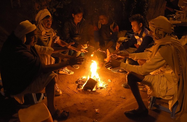
New Delhi, (Samajweekly) Cold wave and Cold Day conditions over northwest and central India are very likely to abate gradually after Saturday while there would be a wet spell over northwest, east and northeast India from February 2 to 4, the IMD said.
“No significant change in minimum temperatures is very likely over most parts of northwest and central India during next 24 hours and gradual rise by 4-6 degrees Celsius thereafter,” the India Meteorological Department (IMD) said.
Maximum temperatures are very likely to rise by 3-5 degrees Celsius over most parts of northwest and central India till February 2 and fall thereafter. Surface winds (speed 15-25 kmph) are likely over Punjab, Haryana, Delhi, and Uttar Pradesh during next four days.
No significant change in minimum temperatures is very likely over east India during next 3 days and will fall by 2-4 degrees Celsius thereafter. Similarly, no significant change in minimum temperatures is very likely over Gujarat during the next two days and rise by 2-4 degrees Celsius thereafter.
Cold wave conditions in isolated pockets are very likely over Punjab, Haryana-Chandigarh, west Uttar Pradesh, and Rajasthan during next 24 hours and abate thereafter. Cold day conditions in isolated pockets are very likely over Uttar Pradesh and east Rajasthan during next 24 hours and abate thereafter.
Cold Day to Severe Cold Day conditions in isolated pockets very likely over Madhya Pradesh, Vidarbha and Chhattisgarh during next 24 hours and gradually abate thereafter. Cold wave conditions in isolated pockets are very likely over Madhya Pradesh and Odisha during next two days, and over Vidarbha and Chhattisgarh during next 24 hours and gradually abate thereafter.
The IMD ascribed the phenomenon for the cold and also the rain to the presence of Western Disturbance. “A trough runs in the middle tropospheric westerlies and there is a fresh feeble Western Disturbance as a trough in middle tropospheric westerlies, which would move east-north-eastwards and affect Jammu-Kashmir-Ladakh with isolated rainfall/snowfall till February 1,” the IMD said, adding: “An active Western Disturbance & its induced cyclonic circulation is very likely to affect northwest India from February 2.”
Isolated to scattered, light/moderate rainfall is very likely over sub-Himalayan West Bengal, Sikkim, Arunachal Pradesh, Assam, Meghalaya, Nagaland, Manipur, Mizoram, and Tripura on January 31 and February 1.
Isolated thunderstorms/lightning is also very likely over Arunachal Pradesh, Assam, Meghalaya, Nagaland, Manipur, Mizoram, and Tripura during next 24 hours.
Isolated light rainfall is very likely over Tamil Nadu, Puducherry, Karaikal, Kerala, andMahe during next four days and over coastal Andhra Pradesh and Yanam during next 48 hours.
Under the influence of a fresh active Western Disturbance and its induced cyclonic circulation, fairly widespread to widespread light/moderate rainfal/snowfall is very likely over Western Himalayan Region during February 2 to 4. Isolated heavy rainfall/ snowfall is also likely over Jammu, Kashmir, Gilgit, Baltistan, Muzaffarabad and Himachal Pradesh on February 3.
Scattered to fairly widespread light/moderate rainfall is very likely over Punjab, Haryana, Chandigarh, Delhi, and Uttar Pradesh during February 2 to 4.
Due to confluence between westerlies and easterlies at lower tropospheric levels, scattered to fairly widespread light/moderate rainfall with isolated hailstorms is likely over Bihar, Jharkhand, West Bengal, and Sikkim on February 3 and 4 and over Assam, Meghalaya, Nagaland, Manipur, Mizoram, and Tripura on February 4 and 5.


